
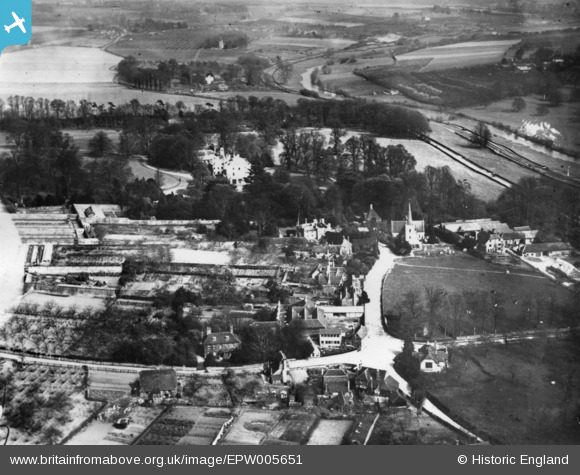
EPW005651 ENGLAND (1921). The village, Teston, 1921. This image has been produced from a print.
© Copyright OpenStreetMap contributors and licensed by the OpenStreetMap Foundation. 2025. Cartography is licensed as CC BY-SA.
Nearby Images (2)
EPW005651

EPW005664

Details
| Title | [EPW005651] The village, Teston, 1921. This image has been produced from a print. |
| Reference | EPW005651 |
| Date | March-1921 |
| Link | |
| Place name | TESTON |
| Parish | TESTON |
| District | |
| Country | ENGLAND |
| Easting / Northing | 570546, 153577 |
| Longitude / Latitude | 0.44431377657312, 51.255303333112 |
| National Grid Reference | TQ705536 |
Pins

Kentishman |
Saturday 18th of March 2017 04:11:33 PM | |
|
Kentishman |
Thursday 1st of January 2015 04:52:15 PM | |
|
Kentishman |
Thursday 1st of January 2015 04:49:57 PM | |
|
Kentishman |
Thursday 1st of January 2015 04:43:40 PM | |
|
Kentishman |
Thursday 1st of January 2015 04:42:53 PM | |
|
Kentishman |
Thursday 1st of January 2015 04:41:30 PM |