
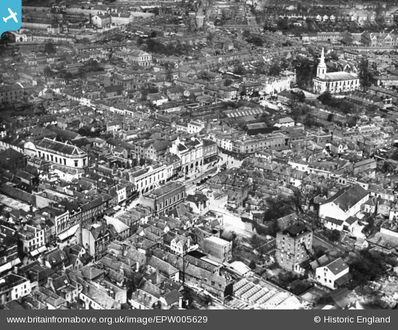
EPW005629 ENGLAND (1921). The town centre, Maidstone, 1921. This image has been produced from a print.
© Copyright OpenStreetMap contributors and licensed by the OpenStreetMap Foundation. 2026. Cartography is licensed as CC BY-SA.
Nearby Images (8)
EPW005629

EPW001456

EPW009209

EAW021784

EPW026073

EPW005632

EPW016897

EPW009210

Details
| Title | [EPW005629] The town centre, Maidstone, 1921. This image has been produced from a print. |
| Reference | EPW005629 |
| Date | March-1921 |
| Link | |
| Place name | MAIDSTONE |
| Parish | |
| District | |
| Country | ENGLAND |
| Easting / Northing | 576069, 155775 |
| Longitude / Latitude | 0.5244721481931, 51.273371668123 |
| National Grid Reference | TQ761558 |
Pins

smokey |
Thursday 13th of January 2022 06:49:25 PM | |
|
JimmyBrandon |
Tuesday 27th of August 2019 02:06:42 PM |