
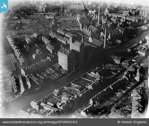
EPW005413 ENGLAND (1921). The Albion Flour Mills and Royal Porcelain Works, Worcester, 1921
© Copyright OpenStreetMap contributors and licensed by the OpenStreetMap Foundation. 2026. Cartography is licensed as CC BY-SA.
Nearby Images (6)
EPW005413

EPW000201

EPW005412

EAW046117

EPW048086

EPW000202

Details
| Title | [EPW005413] The Albion Flour Mills and Royal Porcelain Works, Worcester, 1921 |
| Reference | EPW005413 |
| Date | March-1921 |
| Link | |
| Place name | WORCESTER |
| Parish | |
| District | |
| Country | ENGLAND |
| Easting / Northing | 385084, 254090 |
| Longitude / Latitude | -2.2181932494722, 52.184452157859 |
| National Grid Reference | SO851541 |
Pins

Ian |
Friday 5th of July 2013 05:01:12 PM |