
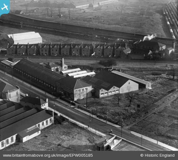
EPW005185 ENGLAND (1921). George Philip and Sons Geographical Institute, Acton, 1921
© Copyright OpenStreetMap contributors and licensed by the OpenStreetMap Foundation. 2026. Cartography is licensed as CC BY-SA.
Nearby Images (38)
EPW005185

EPW044097

EPW005214

EPW005172

EPW044100

EPW044098

EPW005173

EPW005211

EPW005213

EPW044099

EPW005174

EPW005210

EPW005171

EPW005212

EPW005183

EPW058336

EPW005170

EAW033527

EPW005169

EAW009102

EPW034968

EPW034968
EPW034966

EPW034965

EPW034965
EPW034964

EPW034964
EPW054162

EPW054157

EPW054160

EPW034967

EPW034967
EPW046954

EPW046956

EAW009104

EPW062166

EPW046957

EPW054161

Details
| Title | [EPW005185] George Philip and Sons Geographical Institute, Acton, 1921 |
| Reference | EPW005185 |
| Date | 20-January-1921 |
| Link | |
| Place name | ACTON |
| Parish | |
| District | |
| Country | ENGLAND |
| Easting / Northing | 521194, 182205 |
| Longitude / Latitude | -0.25281488948099, 51.525256623345 |
| National Grid Reference | TQ212822 |


