
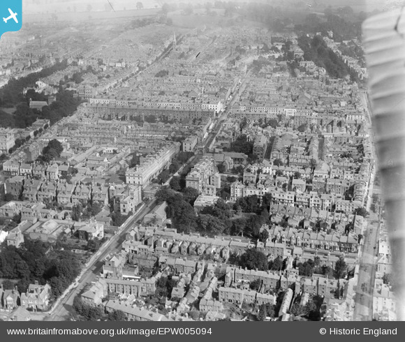
EPW005094 ENGLAND (1920). General view of the town centre, Royal Leamington Spa, 1920
© Copyright OpenStreetMap contributors and licensed by the OpenStreetMap Foundation. 2026. Cartography is licensed as CC BY-SA.
Nearby Images (13)
EPW005094

EPW053220

EPW000414

EPW019736

EAW024688

EPW001217

EPW039094

EPW005098

EPW005095

EPW000413

EPW005092

EPW005097

EPW001219

Details
| Title | [EPW005094] General view of the town centre, Royal Leamington Spa, 1920 |
| Reference | EPW005094 |
| Date | October-1920 |
| Link | |
| Place name | ROYAL LEAMINGTON SPA |
| Parish | ROYAL LEAMINGTON SPA |
| District | |
| Country | ENGLAND |
| Easting / Northing | 431524, 266037 |
| Longitude / Latitude | -1.5377543780059, 52.291169313459 |
| National Grid Reference | SP315660 |
Pins
 |

Gary Turner |
Tuesday 20th of December 2022 01:13:59 PM |
|
Graham |
Sunday 22nd of April 2018 08:56:14 PM |