
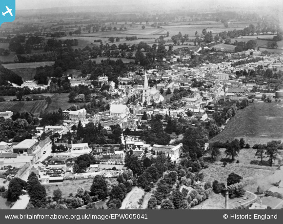
EPW005041 ENGLAND (1920). The town, Buckingham, from the south, 1920. This image has been produced from a copy-negative.
© Copyright OpenStreetMap contributors and licensed by the OpenStreetMap Foundation. 2026. Cartography is licensed as CC BY-SA.
Nearby Images (6)
EPW005041

EPW005042

EPW005040

EAW048982

EAW015426

EAW015424

Details
| Title | [EPW005041] The town, Buckingham, from the south, 1920. This image has been produced from a copy-negative. |
| Reference | EPW005041 |
| Date | July-1920 |
| Link | |
| Place name | BUCKINGHAM |
| Parish | BUCKINGHAM |
| District | |
| Country | ENGLAND |
| Easting / Northing | 469424, 233567 |
| Longitude / Latitude | -0.98871874272053, 51.995778207163 |
| National Grid Reference | SP694336 |
Pins
Be the first to add a comment to this image!