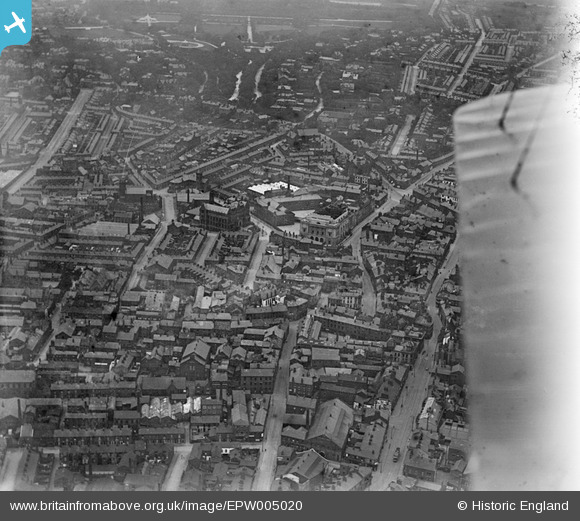
EPW005020 ENGLAND (1920). General view of the town centre, Blackburn, 1920
© Copyright OpenStreetMap contributors and licensed by the OpenStreetMap Foundation. 2026. Cartography is licensed as CC BY-SA.
Details
| Title | [EPW005020] General view of the town centre, Blackburn, 1920 |
| Reference | EPW005020 |
| Date | August-1920 |
| Link | |
| Place name | BLACKBURN |
| Parish | |
| District | |
| Country | ENGLAND |
| Easting / Northing | 368035, 428138 |
| Longitude / Latitude | -2.484776868384, 53.74841195556 |
| National Grid Reference | SD680281 |
Pins

ewoodeddie1968 |
Monday 26th of September 2022 06:16:52 PM | |

ewoodeddie1968 |
Monday 26th of September 2022 06:15:57 PM | |

ewoodeddie1968 |
Friday 2nd of July 2021 09:48:07 PM | |

ewoodeddie1968 |
Friday 2nd of July 2021 09:45:23 PM | |

powerpop |
Saturday 7th of July 2018 08:44:16 PM | |

powerpop |
Saturday 7th of July 2018 08:43:24 PM | |

powerpop |
Saturday 7th of July 2018 08:41:15 PM | |

powerpop |
Saturday 7th of July 2018 08:39:07 PM | |

powerpop |
Saturday 7th of July 2018 08:37:18 PM | |

powerpop |
Saturday 7th of July 2018 08:36:12 PM |


![[EPW005020] General view of the town centre, Blackburn, 1920](http://britainfromabove.org.uk/sites/all/libraries/aerofilms-images/public/100x100/EPW/005/EPW005020.jpg)
![[EPW005017] The Town Hall and town centre, Blackburn, 1920](http://britainfromabove.org.uk/sites/all/libraries/aerofilms-images/public/100x100/EPW/005/EPW005017.jpg)