
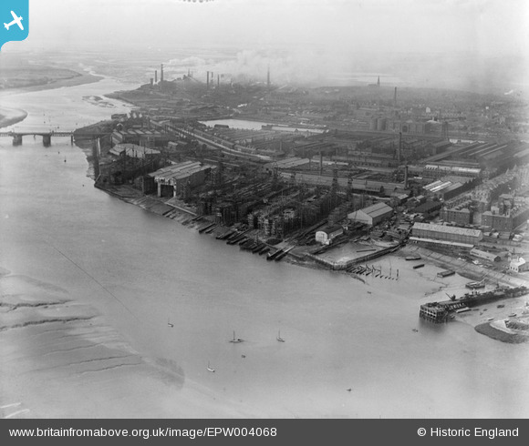
EPW004068 ENGLAND (1920). The Shipbuilding Yard, Barrow-in-Furness, 1920
© Copyright OpenStreetMap contributors and licensed by the OpenStreetMap Foundation. 2026. Cartography is licensed as CC BY-SA.
Nearby Images (2)
EPW004068

EPW004064

Details
| Title | [EPW004068] The Shipbuilding Yard, Barrow-in-Furness, 1920 |
| Reference | EPW004068 |
| Date | July-1920 |
| Link | |
| Place name | BARROW ISLAND |
| Parish | |
| District | |
| Country | ENGLAND |
| Easting / Northing | 319277, 468078 |
| Longitude / Latitude | -3.2346516531018, 54.102072326335 |
| National Grid Reference | SD193681 |
Pins
User Comment Contributions
This image includes part of Walney Island on the left, (West) and part of Barrow Island on which the slipways are situated |

Robert - Cumbria |
Tuesday 26th of June 2012 08:52:05 PM |