
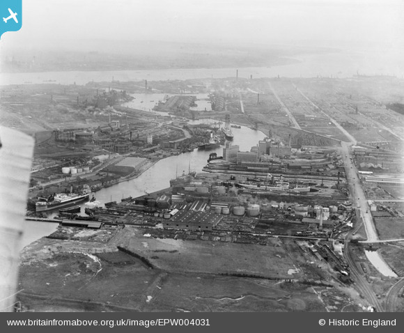
EPW004031 ENGLAND (1920). The West Float and River Mersey, Birkenhead, from the north-west, 1920
© Copyright OpenStreetMap contributors and licensed by the OpenStreetMap Foundation. 2026. Cartography is licensed as CC BY-SA.
Nearby Images (12)
EPW004031

EPW053315

EPW018914

EPW011217

EPW018916

EPW018915

EPW013690

EPW013692

EPW013693

EPW018917

EPW053313

EPW013691

Details
| Title | [EPW004031] The West Float and River Mersey, Birkenhead, from the north-west, 1920 |
| Reference | EPW004031 |
| Date | July-1920 |
| Link | |
| Place name | BIRKENHEAD |
| Parish | |
| District | |
| Country | ENGLAND |
| Easting / Northing | 329879, 390705 |
| Longitude / Latitude | -3.0549561499631, 53.408234631493 |
| National Grid Reference | SJ299907 |
Pins

XMAS DAY |
Monday 17th of June 2024 03:47:01 PM | |
|
XMAS DAY |
Tuesday 25th of July 2023 05:19:53 PM | |
|
XMAS DAY |
Tuesday 25th of July 2023 05:16:21 PM | |
|
XMAS DAY |
Tuesday 25th of July 2023 05:13:00 PM | |
|
MB |
Tuesday 20th of September 2016 09:20:47 AM | |
|
MB |
Tuesday 20th of September 2016 09:06:10 AM | |
Built in 1913 for Joseph Rank |
MB |
Tuesday 20th of September 2016 09:08:03 AM |
|
Pete65 |
Saturday 26th of July 2014 04:24:56 PM | |
|
Pete65 |
Saturday 26th of July 2014 04:23:02 PM | |
|
Pete65 |
Saturday 26th of July 2014 04:20:36 PM |