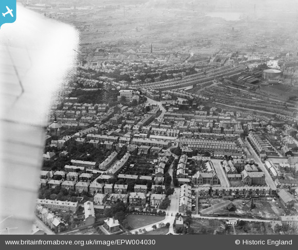
EPW004030 ENGLAND (1920). Church Road and environs, Birkenhead, 1920
© Copyright OpenStreetMap contributors and licensed by the OpenStreetMap Foundation. 2026. Cartography is licensed as CC BY-SA.
Nearby Images (2)
EPW004030

EAW029291

Details
| Title | [EPW004030] Church Road and environs, Birkenhead, 1920 |
| Reference | EPW004030 |
| Date | July-1920 |
| Link | |
| Place name | BIRKENHEAD |
| Parish | |
| District | |
| Country | ENGLAND |
| Easting / Northing | 332055, 387811 |
| Longitude / Latitude | -3.0216013084574, 53.382507497524 |
| National Grid Reference | SJ321878 |
Pins

XMAS DAY |
Tuesday 25th of July 2023 04:19:11 PM | |
|
nemo20000 |
Sunday 5th of June 2022 04:13:57 PM | |
|
steve |
Sunday 7th of February 2021 12:59:36 PM | |
|
BillSumner |
Sunday 30th of November 2014 05:43:45 PM | |
|
BillSumner |
Sunday 30th of November 2014 05:42:46 PM | |
|
Barry |
Wednesday 25th of July 2012 01:26:21 PM | |
|
Barry |
Wednesday 25th of July 2012 01:17:25 PM | |
|
anna |
Wednesday 18th of July 2012 08:36:40 PM | |
|
anna |
Wednesday 18th of July 2012 08:34:09 PM | |
|
anna |
Wednesday 18th of July 2012 08:31:38 PM | |
|
anna |
Wednesday 18th of July 2012 08:30:36 PM | |
|
anna |
Wednesday 18th of July 2012 08:29:27 PM |