
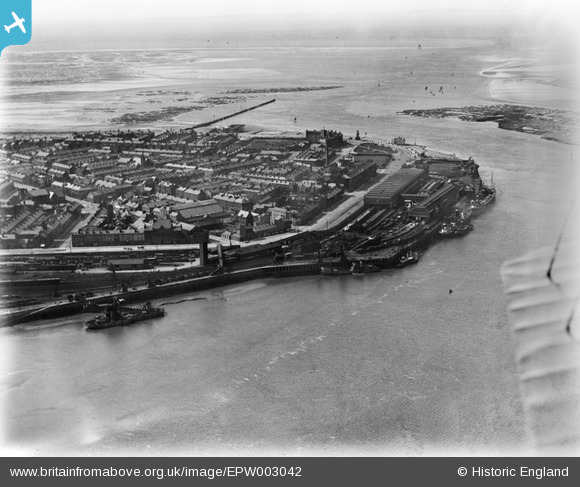
EPW003042 ENGLAND (1920). The Quayside, Fleetwood, from the south-east, 1920
© Copyright OpenStreetMap contributors and licensed by the OpenStreetMap Foundation. 2026. Cartography is licensed as CC BY-SA.
Nearby Images (2)
EPW003042

EPW038737

Details
| Title | [EPW003042] The Quayside, Fleetwood, from the south-east, 1920 |
| Reference | EPW003042 |
| Date | July-1920 |
| Link | |
| Place name | FLEETWOOD |
| Parish | FLEETWOOD |
| District | |
| Country | ENGLAND |
| Easting / Northing | 334206, 447860 |
| Longitude / Latitude | -3.0019814906061, 53.922492663022 |
| National Grid Reference | SD342479 |
Pins

Ginger79 |
Saturday 12th of April 2025 04:53:58 AM | |

Paul Williams |
Wednesday 15th of November 2023 06:30:22 PM | |
|
mildale |
Saturday 29th of January 2022 09:19:42 PM | |
|
mannidaze |
Saturday 15th of November 2014 07:37:06 PM |
