
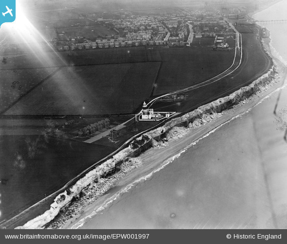
EPW001997 ENGLAND (1920). The Lighthouse, Hunstanton, 1920
© Copyright OpenStreetMap contributors and licensed by the OpenStreetMap Foundation. 2026. Cartography is licensed as CC BY-SA.
Nearby Images (3)
EPW001997

EPW001849

EAW008203

Details
| Title | [EPW001997] The Lighthouse, Hunstanton, 1920 |
| Reference | EPW001997 |
| Date | June-1920 |
| Link | |
| Place name | HUNSTANTON |
| Parish | HUNSTANTON |
| District | |
| Country | ENGLAND |
| Easting / Northing | 567632, 342055 |
| Longitude / Latitude | 0.49539161539544, 52.949334960477 |
| National Grid Reference | TF676421 |
