
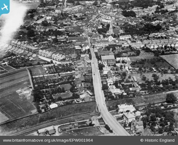
EPW001964 ENGLAND (1920). The High Street, Braintree, 1920. This image has been produced from a copy-negative.
© Copyright OpenStreetMap contributors and licensed by the OpenStreetMap Foundation. 2026. Cartography is licensed as CC BY-SA.
Nearby Images (3)
EPW001964

EPW001744

EAW043698

Details
| Title | [EPW001964] The High Street, Braintree, 1920. This image has been produced from a copy-negative. |
| Reference | EPW001964 |
| Date | June-1920 |
| Link | |
| Place name | BRAINTREE |
| Parish | |
| District | |
| Country | ENGLAND |
| Easting / Northing | 575431, 222812 |
| Longitude / Latitude | 0.54881814296722, 51.87580235913 |
| National Grid Reference | TL754228 |
Pins

David960 |
Saturday 16th of February 2019 04:41:43 PM | |
|
totoro |
Wednesday 24th of September 2014 07:50:27 PM | |
|
totoro |
Wednesday 24th of September 2014 07:46:53 PM | |
|
totoro |
Wednesday 24th of September 2014 07:44:32 PM | |
|
totoro |
Wednesday 24th of September 2014 07:42:36 PM | |
|
totoro |
Wednesday 24th of September 2014 07:41:07 PM | |
|
totoro |
Wednesday 24th of September 2014 07:39:17 PM | |
|
totoro |
Wednesday 24th of September 2014 07:35:18 PM | |
|
totoro |
Wednesday 24th of September 2014 07:32:31 PM | |
|
totoro |
Wednesday 24th of September 2014 07:22:09 PM |