
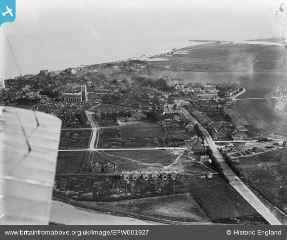
EPW001927 ENGLAND (1920). General view of Southwold and St Edmund's Church, Southwold, 1920
© Copyright OpenStreetMap contributors and licensed by the OpenStreetMap Foundation. 2026. Cartography is licensed as CC BY-SA.
Nearby Images (5)
EPW001927

EPW001926

EAW024298

EAW038320

EAW038327

Details
| Title | [EPW001927] General view of Southwold and St Edmund's Church, Southwold, 1920 |
| Reference | EPW001927 |
| Date | June-1920 |
| Link | |
| Place name | SOUTHWOLD |
| Parish | SOUTHWOLD |
| District | |
| Country | ENGLAND |
| Easting / Northing | 650597, 276466 |
| Longitude / Latitude | 1.6783030300197, 52.328561588769 |
| National Grid Reference | TM506765 |
Pins

bugbear |
Sunday 8th of March 2015 12:53:23 PM | |
|
bugbear |
Friday 18th of October 2013 08:53:06 PM | |

Class31 |
Monday 9th of July 2012 10:12:07 PM | |
|
Class31 |
Monday 9th of July 2012 10:11:26 PM | |
|
Class31 |
Monday 9th of July 2012 10:08:12 PM | |
|
Class31 |
Monday 9th of July 2012 10:07:32 PM | |
|
Class31 |
Monday 9th of July 2012 10:04:59 PM | |
|
Class31 |
Monday 9th of July 2012 10:03:32 PM |