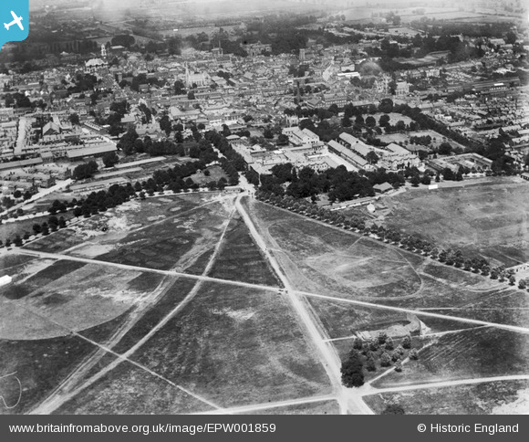
EPW001859 ENGLAND (1920). View of Colchester, St John's Abbey and the Abbey Field, Colchester, 1920
© Copyright OpenStreetMap contributors and licensed by the OpenStreetMap Foundation. 2026. Cartography is licensed as CC BY-SA.
Details
| Title | [EPW001859] View of Colchester, St John's Abbey and the Abbey Field, Colchester, 1920 |
| Reference | EPW001859 |
| Date | June-1920 |
| Link | |
| Place name | COLCHESTER |
| Parish | |
| District | |
| Country | ENGLAND |
| Easting / Northing | 599651, 224486 |
| Longitude / Latitude | 0.90121880866851, 51.882692139926 |
| National Grid Reference | TL997245 |
Pins

HAJ |
Wednesday 31st of July 2019 08:12:22 PM | |

HAJ |
Monday 22nd of May 2017 10:20:31 AM | |

Mark C |
Saturday 8th of August 2015 06:36:53 PM | |

Mark C |
Saturday 8th of August 2015 06:36:48 PM | |

Mark C |
Saturday 15th of December 2012 05:37:19 PM |


![[EPW001859] View of Colchester, St John's Abbey and the Abbey Field, Colchester, 1920](http://britainfromabove.org.uk/sites/all/libraries/aerofilms-images/public/100x100/EPW/001/EPW001859.jpg)
![[EAW043689] The site of the Benedictine Abbey of St John and the town, Colchester, from the south, 1952](http://britainfromabove.org.uk/sites/all/libraries/aerofilms-images/public/100x100/EAW/043/EAW043689.jpg)
![[EAW043690] The site of the Benedictine Abbey of St John and the town, Colchester, from the south, 1952](http://britainfromabove.org.uk/sites/all/libraries/aerofilms-images/public/100x100/EAW/043/EAW043690.jpg)
![[EAW043688] Le Cateau Baracks and the town, Colchester, from the south-west, 1952](http://britainfromabove.org.uk/sites/all/libraries/aerofilms-images/public/100x100/EAW/043/EAW043688.jpg)