
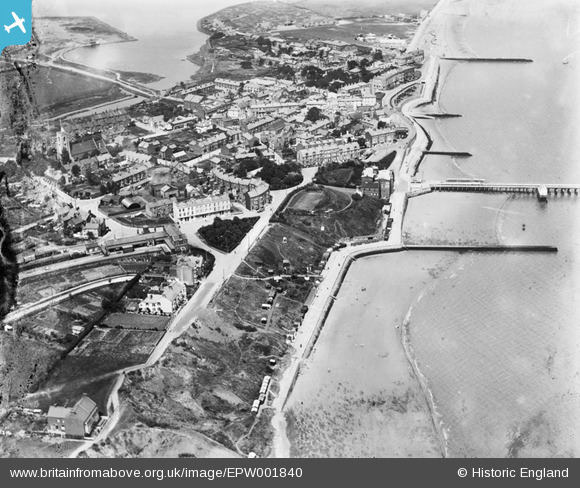
EPW001840 ENGLAND (1920). View of the town centre, Walton-on-the-Naze, 1920
© Copyright OpenStreetMap contributors and licensed by the OpenStreetMap Foundation. 2026. Cartography is licensed as CC BY-SA.
Nearby Images (14)
EPW001840

EPW001844

EPW049026

EPW018535

EPW001843

EPW049025

EPW001838

EPW001845

EPW011639

EAW025884

EPW001842

EPW001839

EPW039296

EAW025885

Details
| Title | [EPW001840] View of the town centre, Walton-on-the-Naze, 1920 |
| Reference | EPW001840 |
| Date | June-1920 |
| Link | |
| Place name | WALTON-ON-THE-NAZE |
| Parish | FRINTON AND WALTON |
| District | |
| Country | ENGLAND |
| Easting / Northing | 625298, 221448 |
| Longitude / Latitude | 1.2713068954731, 51.845648183151 |
| National Grid Reference | TM253214 |
Pins

robert i wallace |
Monday 8th of June 2026 04:29:01 PM | |

Matt Aldred edob.mattaldred.com |
Saturday 5th of December 2020 02:31:43 PM | |
|
redmist |
Monday 2nd of March 2020 07:15:42 PM | |
|
redmist |
Monday 2nd of March 2020 07:14:48 PM | |
|
Blake1 |
Wednesday 6th of September 2017 02:41:51 PM |