
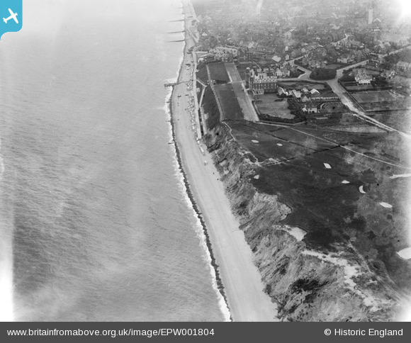
EPW001804 ENGLAND (1920). The Grand Hotel, Golf course and The Promenade, Sheringham, 1920
© Copyright OpenStreetMap contributors and licensed by the OpenStreetMap Foundation. 2026. Cartography is licensed as CC BY-SA.
Nearby Images (4)
EPW001804

EAW051656

EPW021201

EPW001805

Details
| Title | [EPW001804] The Grand Hotel, Golf course and The Promenade, Sheringham, 1920 |
| Reference | EPW001804 |
| Date | June-1920 |
| Link | |
| Place name | SHERINGHAM |
| Parish | SHERINGHAM |
| District | |
| Country | ENGLAND |
| Easting / Northing | 615360, 343569 |
| Longitude / Latitude | 1.2058030823628, 52.945898596193 |
| National Grid Reference | TG154436 |
Pins

User Comment Contributions
here there was a hand operated winch for pulling the crab boats up the beach and shingle |

Farrowbee |
Friday 21st of August 2015 06:36:40 PM |

The Grand Hotel was built in 1889. Of course, due to the continual erosion, much of the original golf course has been lost to the sea and the course extended on land to the west. |
royalfixit |
Wednesday 27th of June 2012 05:47:03 AM |