
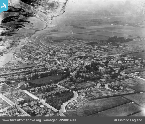
EPW001488 ENGLAND (1920). General view of the town centre, Littlehampton, from the south-east, 1920
© Copyright OpenStreetMap contributors and licensed by the OpenStreetMap Foundation. 2026. Cartography is licensed as CC BY-SA.
Nearby Images (6)
EPW001488

EPW001489

EPW039468

EPW001487

EAW012227

EAW012228

Details
| Title | [EPW001488] General view of the town centre, Littlehampton, from the south-east, 1920 |
| Reference | EPW001488 |
| Date | June-1920 |
| Link | |
| Place name | LITTLEHAMPTON |
| Parish | LITTLEHAMPTON |
| District | |
| Country | ENGLAND |
| Easting / Northing | 502791, 102132 |
| Longitude / Latitude | -0.54091504495583, 50.809046729458 |
| National Grid Reference | TQ028021 |
Pins

alastair wallace |
Thursday 29th of October 2015 08:29:34 PM | |
|
JerryE |
Thursday 17th of October 2013 05:44:17 PM | |
|
helen |
Sunday 7th of October 2012 06:32:56 PM |