
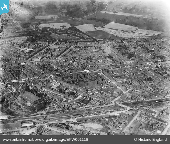
EPW001118 ENGLAND (1920). General view of West Bromwich including High Street and Dartmouth Park, 1920
© Copyright OpenStreetMap contributors and licensed by the OpenStreetMap Foundation. 2026. Cartography is licensed as CC BY-SA.
Nearby Images (6)
EPW001118

EPW057562

EPW061254

EPW057565

EPW021861

EPW021863

Details
| Title | [EPW001118] General view of West Bromwich including High Street and Dartmouth Park, 1920 |
| Reference | EPW001118 |
| Date | May-1920 |
| Link | |
| Place name | WEST BROMWICH |
| Parish | |
| District | |
| Country | ENGLAND |
| Easting / Northing | 400877, 290883 |
| Longitude / Latitude | -1.9870749465019, 52.515466626256 |
| National Grid Reference | SP009909 |
Pins

kevofbrum |
Monday 22nd of July 2019 09:50:33 AM | |
|
DaveT |
Tuesday 11th of March 2014 12:25:55 PM | |
|
scoop115 |
Sunday 22nd of December 2013 08:04:12 PM | |
|
Lou789 |
Friday 13th of July 2012 11:04:42 PM | |
|
Lou789 |
Friday 13th of July 2012 11:04:02 PM |