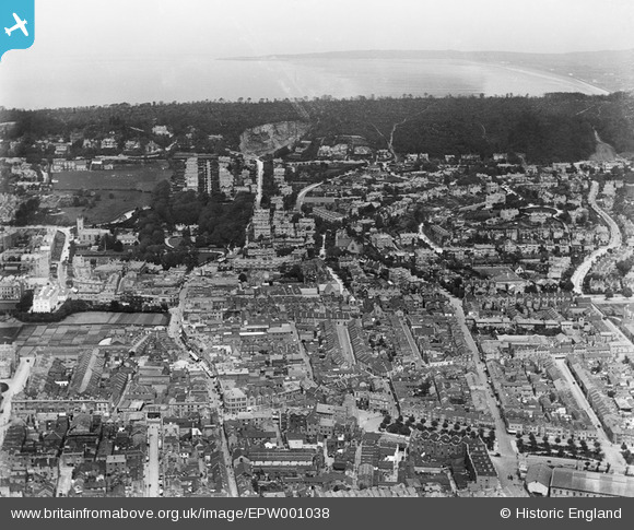
EPW001038 ENGLAND (1920). View over Weston-Super-Mare, Weston-Super-Mare, from the south, 1920
    © Copyright OpenStreetMap contributors and licensed by the OpenStreetMap Foundation. 2025. Cartography is licensed as CC BY-SA.
  
Nearby Images (5)
Details
| Title | [EPW001038] View over Weston-Super-Mare, Weston-Super-Mare, from the south, 1920 | 
| Reference | EPW001038 | 
| Date | May-1920 | 
| Link | |
| Place name | WESTON-SUPER-MARE | 
| Parish | WESTON-SUPER-MARE | 
| District | |
| Country | ENGLAND | 
| Easting / Northing | 332008, 161439 | 
| Longitude / Latitude | -2.9763804029769, 51.347458500411 | 
| National Grid Reference | ST320614 | 
Pins
Be the first to add a comment to this image!
 
             
  ![[EPW001038] View over Weston-Super-Mare, Weston-Super-Mare, from the south, 1920](http://britainfromabove.org.uk/sites/all/libraries/aerofilms-images/public/100x100/EPW/001/EPW001038.jpg) 
  
                                          ![[EPW048456] The Grand Pier and the town, Weston-Super-Mare, from the south, 1935](http://britainfromabove.org.uk/sites/all/libraries/aerofilms-images/public/100x100/EPW/048/EPW048456.jpg) 
 ![[EPW048457] The Grand Pier and the town, Weston-Super-Mare, from the south, 1935](http://britainfromabove.org.uk/sites/all/libraries/aerofilms-images/public/100x100/EPW/048/EPW048457.jpg) 
 ![[EPW039936] Marine Parade, Beach Road and environs, Weston-super-Mare, 1932](http://britainfromabove.org.uk/sites/all/libraries/aerofilms-images/public/100x100/EPW/039/EPW039936.jpg) 
 ![[EAW056067] Worlebury Hill and the sea front, Weston-super-Mare, from the south-east, 1954](http://britainfromabove.org.uk/sites/all/libraries/aerofilms-images/public/100x100/EAW/056/EAW056067.jpg)