
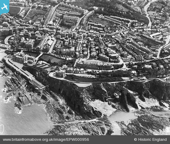
EPW000956 ENGLAND (1920). Granville Road and Wilder Road area, Ilfracombe, 1920
© Copyright OpenStreetMap contributors and licensed by the OpenStreetMap Foundation. 2026. Cartography is licensed as CC BY-SA.
Nearby Images (8)
EPW000956

EPW032992

EPW039944

EPW039945

EPW032989

EPW039949

EPW032981

EPW032982

Details
| Title | [EPW000956] Granville Road and Wilder Road area, Ilfracombe, 1920 |
| Reference | EPW000956 |
| Date | May-1920 |
| Link | |
| Place name | ILFRACOMBE |
| Parish | ILFRACOMBE |
| District | |
| Country | ENGLAND |
| Easting / Northing | 251617, 147734 |
| Longitude / Latitude | -4.1244988917286, 51.208993705356 |
| National Grid Reference | SS516477 |
Pins

Class31 |
Wednesday 24th of August 2016 02:34:10 PM | |

LadyDocker |
Tuesday 26th of June 2012 02:23:42 PM | |
|
LadyDocker |
Tuesday 26th of June 2012 02:20:33 PM | |
|
LadyDocker |
Tuesday 26th of June 2012 02:18:25 PM |

User Comment Contributions

Here's a picture of this area from 1912. Outside the Osborne Hotel, Wilder Road |
BruceR |
Tuesday 6th of November 2012 06:59:33 PM |
Oxford Grove - a steep hill with, at the bottom, Barclays Bank on the right and the Railway Booking Office on the left. |
LadyDocker |
Tuesday 26th of June 2012 02:30:55 PM |