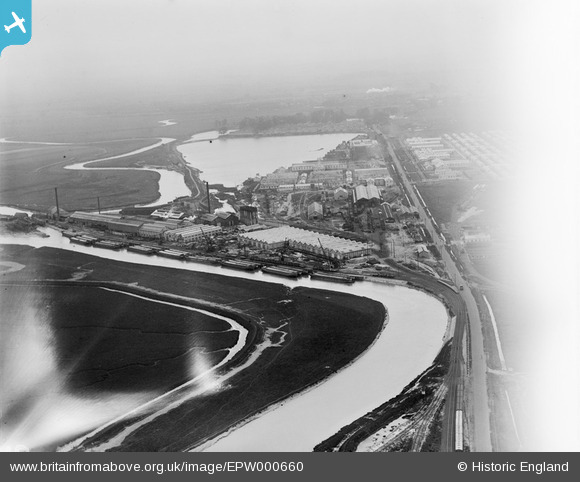
EPW000660 ENGLAND (1920). Great Stonar, Sandwich, from the north, 1920
© Copyright OpenStreetMap contributors and licensed by the OpenStreetMap Foundation. 2026. Cartography is licensed as CC BY-SA.
Details
| Title | [EPW000660] Great Stonar, Sandwich, from the north, 1920 |
| Reference | EPW000660 |
| Date | April-1920 |
| Link | |
| Place name | GREAT STONAR |
| Parish | WORTH |
| District | |
| Country | ENGLAND |
| Easting / Northing | 633495, 160227 |
| Longitude / Latitude | 1.3494307197969, 51.292709685408 |
| National Grid Reference | TR335602 |
Pins

Simon Cox |
Thursday 14th of August 2014 01:26:38 PM | |

The Laird |
Sunday 29th of June 2014 05:04:18 PM | |

The Laird |
Sunday 29th of June 2014 05:03:31 PM | |

Tudds |
Thursday 10th of January 2013 01:30:45 PM |


![[EPW000660] Great Stonar, Sandwich, from the north, 1920](http://britainfromabove.org.uk/sites/all/libraries/aerofilms-images/public/100x100/EPW/000/EPW000660.jpg)
![[EAW031811] The Pfizer Pharmaceutical Works, Great Stonar, 1950. This image was marked by Aerofilms Ltd for photo editing.](http://britainfromabove.org.uk/sites/all/libraries/aerofilms-images/public/100x100/EAW/031/EAW031811.jpg)
![[EAW031808] The Pfizer Pharmaceutical Works, Great Stonar, 1950. This image was marked by Aerofilms Ltd for photo editing.](http://britainfromabove.org.uk/sites/all/libraries/aerofilms-images/public/100x100/EAW/031/EAW031808.jpg)