
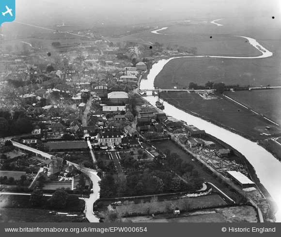
EPW000654 ENGLAND (1920). Sandwich, from the south-east, 1920
© Copyright OpenStreetMap contributors and licensed by the OpenStreetMap Foundation. 2026. Cartography is licensed as CC BY-SA.
Nearby Images (5)
EPW000654

EPW035441

EPW039309

EPW035440

EPW000655

Details
| Title | [EPW000654] Sandwich, from the south-east, 1920 |
| Reference | EPW000654 |
| Date | April-1920 |
| Link | |
| Place name | SANDWICH |
| Parish | SANDWICH |
| District | |
| Country | ENGLAND |
| Easting / Northing | 633367, 158115 |
| Longitude / Latitude | 1.3462183571736, 51.273801701175 |
| National Grid Reference | TR334581 |
Pins

Stu Giles |
Thursday 17th of May 2018 09:26:57 AM | |

Alan McFaden |
Wednesday 9th of July 2014 11:16:58 AM | |
|
Alan McFaden |
Wednesday 9th of July 2014 11:16:24 AM | |
|
Tom.B |
Wednesday 22nd of January 2014 12:03:38 AM |

