
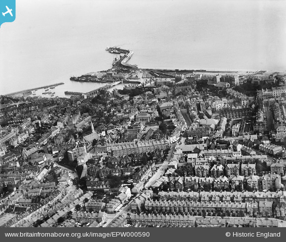
EPW000590 ENGLAND (1920). The town centre and the harbour, Folkestone, from the north-west, 1920
© Copyright OpenStreetMap contributors and licensed by the OpenStreetMap Foundation. 2026. Cartography is licensed as CC BY-SA.
Nearby Images (4)
EPW000590

EPW000379

EPW000355

EAW002373

Details
| Title | [EPW000590] The town centre and the harbour, Folkestone, from the north-west, 1920 |
| Reference | EPW000590 |
| Date | April-1920 |
| Link | |
| Place name | FOLKESTONE |
| Parish | FOLKESTONE |
| District | |
| Country | ENGLAND |
| Easting / Northing | 622775, 136162 |
| Longitude / Latitude | 1.1809917852985, 51.080923604459 |
| National Grid Reference | TR228362 |
Pins

I in the sky |
Monday 19th of December 2022 12:47:21 PM | |
|
Sara |
Tuesday 12th of April 2022 07:35:52 PM | |
|
Simon Davenport |
Monday 3rd of May 2021 07:45:56 PM | |
|
Paolo |
Wednesday 29th of October 2014 09:21:59 PM | |
|
eavyumble |
Saturday 22nd of December 2012 05:33:49 PM | |
|
Paolo |
Saturday 10th of November 2012 04:04:51 PM | |
|
Paolo |
Saturday 10th of November 2012 04:02:46 PM | |
|
Paolo |
Saturday 10th of November 2012 04:01:00 PM | |
|
Paolo |
Saturday 10th of November 2012 03:51:38 PM | |
|
Paolo |
Saturday 10th of November 2012 03:48:44 PM | |
|
Paolo |
Saturday 10th of November 2012 03:46:18 PM |