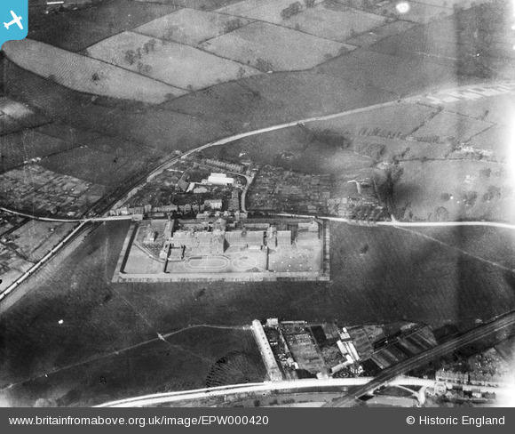
EPW000420 ENGLAND (1920). The prison, Warwick, 1920
© Copyright OpenStreetMap contributors and licensed by the OpenStreetMap Foundation. 2026. Cartography is licensed as CC BY-SA.
Details
| Title | [EPW000420] The prison, Warwick, 1920 |
| Reference | EPW000420 |
| Date | April-1920 |
| Link | |
| Place name | WARWICK |
| Parish | WARWICK |
| District | |
| Country | ENGLAND |
| Easting / Northing | 427683, 265878 |
| Longitude / Latitude | -1.5940875109651, 52.289946729881 |
| National Grid Reference | SP277659 |
Pins

RichLeamington |
Friday 29th of August 2025 02:40:11 PM | |

Sharon |
Sunday 16th of February 2025 04:21:50 AM | |

Sharon |
Saturday 15th of February 2025 12:08:17 PM | |

AndrewGVT |
Monday 6th of July 2015 04:24:17 PM | |

AndrewGVT |
Monday 6th of July 2015 04:23:55 PM | |

AndrewGVT |
Monday 6th of July 2015 04:23:12 PM | |

AndrewGVT |
Monday 6th of July 2015 04:22:23 PM | |

Nicholas Ball |
Monday 24th of September 2012 04:10:38 PM | |

Nicholas Ball |
Monday 24th of September 2012 04:04:16 PM |
User Comment Contributions
Warwick Prison was built at the north end of what is now Cape Road in 1860, to replace the existing Bridewell and Warwick Gaol in Barrack Street. It closed for the reception of new prisoners in 1916 during the First World War, with the last visitors report being recorded in 1917. It was subsequently demolished in 1934. The residential streets of Landor Road and Hanworth Road had been established in its place by 1938. |

oldleamingtonian |
Friday 29th of June 2012 01:00:53 PM |


![[EPW000420] The prison, Warwick, 1920](http://britainfromabove.org.uk/sites/all/libraries/aerofilms-images/public/100x100/EPW/000/EPW000420.jpg)
![[EPW019743] Cape Road, The Cape, 1927](http://britainfromabove.org.uk/sites/all/libraries/aerofilms-images/public/100x100/EPW/019/EPW019743.jpg)