
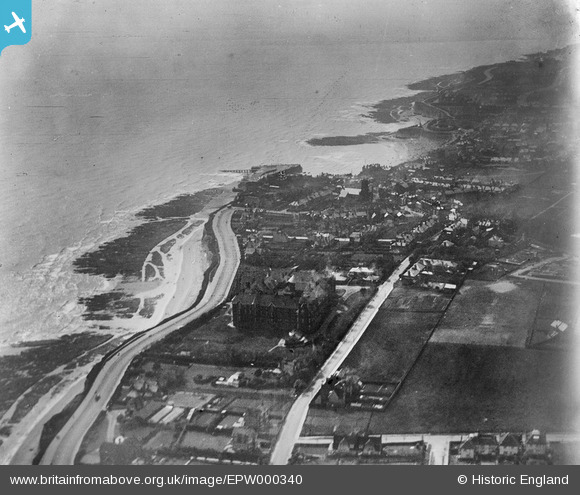
EPW000340 ENGLAND (1920). Broadstairs, Kent, from the north-west, 1920
© Copyright OpenStreetMap contributors and licensed by the OpenStreetMap Foundation. 2026. Cartography is licensed as CC BY-SA.
Nearby Images (4)
EPW000340

EPW000716

EPW009186

EPW000343

Details
| Title | [EPW000340] Broadstairs, Kent, from the north-west, 1920 |
| Reference | EPW000340 |
| Date | April-1920 |
| Link | |
| Place name | BROADSTAIRS |
| Parish | BROADSTAIRS AND ST. PETERS |
| District | |
| Country | ENGLAND |
| Easting / Northing | 639816, 168327 |
| Longitude / Latitude | 1.4453815702301, 51.362793011408 |
| National Grid Reference | TR398683 |
Pins
 |

Beachcomber |
Wednesday 27th of June 2012 07:58:59 PM |
|
Beachcomber |
Wednesday 27th of June 2012 07:52:25 PM | |
|
Beachcomber |
Wednesday 27th of June 2012 07:51:55 PM |