
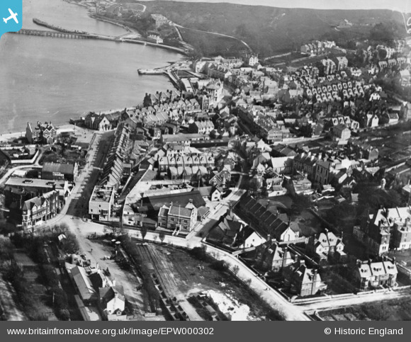
EPW000302 ENGLAND (1920). Station Road and environs, Swanage, 1920. This image has been produced from a copy-negative.
© Copyright OpenStreetMap contributors and licensed by the OpenStreetMap Foundation. 2026. Cartography is licensed as CC BY-SA.
Nearby Images (3)
EPW000302

EAW030873

EPW013664

Details
| Title | [EPW000302] Station Road and environs, Swanage, 1920. This image has been produced from a copy-negative. |
| Reference | EPW000302 |
| Date | April-1920 |
| Link | |
| Place name | SWANAGE |
| Parish | SWANAGE |
| District | |
| Country | ENGLAND |
| Easting / Northing | 403020, 78818 |
| Longitude / Latitude | -1.9573155135364, 50.608483304112 |
| National Grid Reference | SZ030788 |
Pins
Be the first to add a comment to this image!