
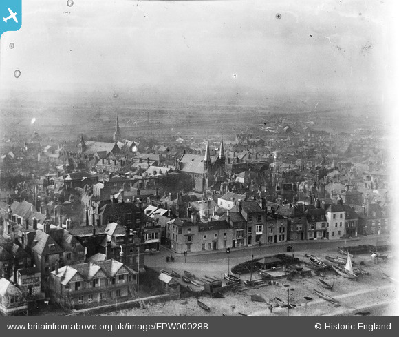
EPW000288 ENGLAND (1920). Deal, Kent, from the south-east, 1920
© Copyright OpenStreetMap contributors and licensed by the OpenStreetMap Foundation. 2026. Cartography is licensed as CC BY-SA.
Nearby Images (7)
EPW000288

EPW000645

EPW000385

EPW019060

EPW000389

EPW000386

EPW009178

Details
| Title | [EPW000288] Deal, Kent, from the south-east, 1920 |
| Reference | EPW000288 |
| Date | May-1920 |
| Link | |
| Place name | DEAL |
| Parish | DEAL |
| District | |
| Country | ENGLAND |
| Easting / Northing | 637650, 152979 |
| Longitude / Latitude | 1.4041065244505, 51.225925931983 |
| National Grid Reference | TR377530 |
Pins

Alan McFaden |
Wednesday 9th of July 2014 10:53:59 AM | |

Simon Cox |
Wednesday 27th of June 2012 11:39:18 AM |
