
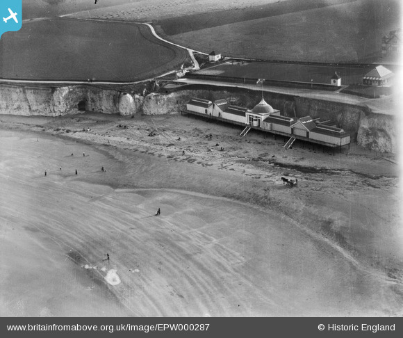
EPW000287 ENGLAND (1920). Pavilion at Sackett's Gap, Margate, 1920
© Copyright OpenStreetMap contributors and licensed by the OpenStreetMap Foundation. 2026. Cartography is licensed as CC BY-SA.
Nearby Images (9)
EPW000287

EPW009166

EPW039330

EPW035475

EPW042851

EPW035472

EPW000639

EPW009235

EPW053802

Details
| Title | [EPW000287] Pavilion at Sackett's Gap, Margate, 1920 |
| Reference | EPW000287 |
| Date | April-1920 |
| Link | |
| Place name | MARGATE |
| Parish | |
| District | |
| Country | ENGLAND |
| Easting / Northing | 637330, 171444 |
| Longitude / Latitude | 1.411815957374, 51.39181757258 |
| National Grid Reference | TR373714 |
Pins
Be the first to add a comment to this image!