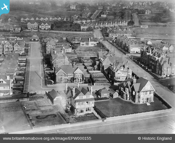
EPW000155 ENGLAND (1920). Bedford Avenue, Bexhill, 1920
© Copyright OpenStreetMap contributors and licensed by the OpenStreetMap Foundation. 2026. Cartography is licensed as CC BY-SA.
Nearby Images (8)
Details
| Title | [EPW000155] Bedford Avenue, Bexhill, 1920 |
| Reference | EPW000155 |
| Date | February-1920 |
| Link | |
| Place name | BEXHILL |
| Parish | |
| District | |
| Country | ENGLAND |
| Easting / Northing | 574916, 107419 |
| Longitude / Latitude | 0.48458238474058, 50.839265202724 |
| National Grid Reference | TQ749074 |
Pins
Be the first to add a comment to this image!


![[EPW000155] Bedford Avenue, Bexhill, 1920](http://britainfromabove.org.uk/sites/all/libraries/aerofilms-images/public/100x100/EPW/000/EPW000155.jpg)
![[EPW026230] Cantelupe Road and environs, Bexhill, 1929](http://britainfromabove.org.uk/sites/all/libraries/aerofilms-images/public/100x100/EPW/026/EPW026230.jpg)
![[EPW016887] The Sackville Hotel and environs, Bexhill, 1926](http://britainfromabove.org.uk/sites/all/libraries/aerofilms-images/public/100x100/EPW/016/EPW016887.jpg)
![[EPW000122] De La Warr Parade, Bexhill, 1920](http://britainfromabove.org.uk/sites/all/libraries/aerofilms-images/public/100x100/EPW/000/EPW000122.jpg)
![[EPW000124] De La Warr Parade, Bexhill, 1920](http://britainfromabove.org.uk/sites/all/libraries/aerofilms-images/public/100x100/EPW/000/EPW000124.jpg)
![[EPW039352] De La Warr Parade and environs, Bexhill, from the east, 1932](http://britainfromabove.org.uk/sites/all/libraries/aerofilms-images/public/100x100/EPW/039/EPW039352.jpg)
![[EPW026224] The Sackville Hotel and De La Warr Parade, Bexhill, 1929](http://britainfromabove.org.uk/sites/all/libraries/aerofilms-images/public/100x100/EPW/026/EPW026224.jpg)
![[EPW026231] A row of beach huts along the seafront at De La Warr Parade, Bexhill, 1929](http://britainfromabove.org.uk/sites/all/libraries/aerofilms-images/public/100x100/EPW/026/EPW026231.jpg)