
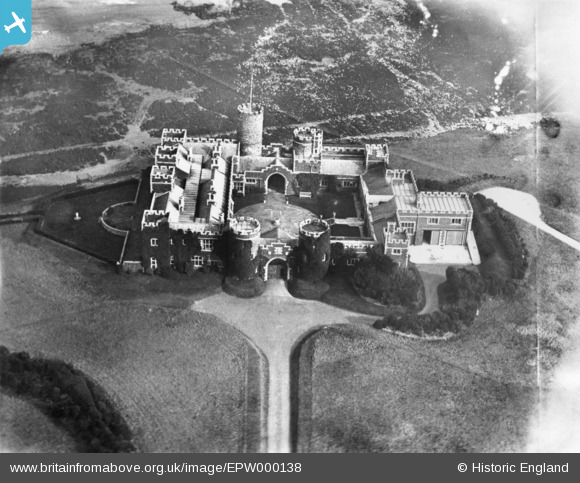
EPW000138 ENGLAND (1920). Kingsgate Castle, Kingsgate, 1920. This image has been produced from a damaged print.
© Copyright OpenStreetMap contributors and licensed by the OpenStreetMap Foundation. 2026. Cartography is licensed as CC BY-SA.
Nearby Images (10)
EPW000138

EPW009171

EPW009168

EPW009170

EPW009169

EAW017588

EAW017587

EAW017582

EAW017584

EAW017585

Details
| Title | [EPW000138] Kingsgate Castle, Kingsgate, 1920. This image has been produced from a damaged print. |
| Reference | EPW000138 |
| Date | February-1920 |
| Link | |
| Place name | KINGSGATE |
| Parish | BROADSTAIRS AND ST. PETERS |
| District | |
| Country | ENGLAND |
| Easting / Northing | 639700, 170523 |
| Longitude / Latitude | 1.4451992077092, 51.382554232597 |
| National Grid Reference | TR397705 |
Pins
Be the first to add a comment to this image!