
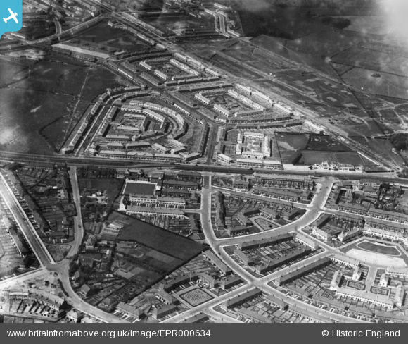
EPR000634 ENGLAND (1935). The Fincham and Huyton Farm housing estates, Huyton-With-Roby, 1935
© Copyright OpenStreetMap contributors and licensed by the OpenStreetMap Foundation. 2025. Cartography is licensed as CC BY-SA.
Nearby Images (3)
EPR000634

EPR000632

EPR000633

Details
| Title | [EPR000634] The Fincham and Huyton Farm housing estates, Huyton-With-Roby, 1935 |
| Reference | EPR000634 |
| Date | May-1935 |
| Link | |
| Place name | HUYTON-WITH-ROBY |
| Parish | |
| District | |
| Country | ENGLAND |
| Easting / Northing | 342604, 391963 |
| Longitude / Latitude | -2.8637667213175, 53.42107988506 |
| National Grid Reference | SJ426920 |
Pins

Miss66 |
Monday 6th of April 2020 10:39:44 PM | |
|
jimmyjoggers |
Monday 10th of November 2014 04:22:25 PM |