
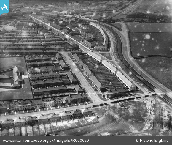
EPR000629 ENGLAND (1935). Houses along Cotsford Road, Huyton-With-Roby, 1935. This image has been produced from a damaged negative.
© Copyright OpenStreetMap contributors and licensed by the OpenStreetMap Foundation. 2026. Cartography is licensed as CC BY-SA.
Nearby Images (2)
EPR000629

EPR000631

Details
| Title | [EPR000629] Houses along Cotsford Road, Huyton-With-Roby, 1935. This image has been produced from a damaged negative. |
| Reference | EPR000629 |
| Date | May-1935 |
| Link | |
| Place name | HUYTON-WITH-ROBY |
| Parish | |
| District | |
| Country | ENGLAND |
| Easting / Northing | 343292, 391795 |
| Longitude / Latitude | -2.8533838671275, 53.419644226604 |
| National Grid Reference | SJ433918 |
Pins
Be the first to add a comment to this image!