
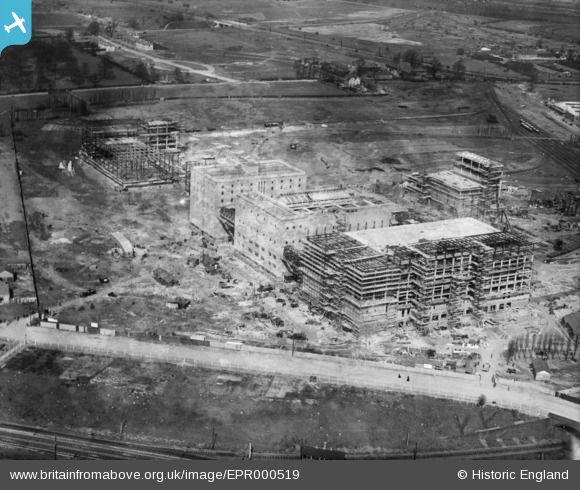
EPR000519 ENGLAND (1935). The Guinness Brewery under construction, Park Royal, 1935. This image has been produced from a damaged negative.
© Copyright OpenStreetMap contributors and licensed by the OpenStreetMap Foundation. 2026. Cartography is licensed as CC BY-SA.
Nearby Images (39)
EPR000519

EAW031542

EAW031545

EAW031547

EPW048434

EAW031546

EAW031548

EPR000520

EAW031551

EAW031543

EAW031553

EPW055718

EAW031544

EAW031549

EPW041844

EPW041848

EPW041852

EPW041850

EPW033807

EPW055630

EPW055633

EAW017046

EAW031552

EPW048435

EPW041859

EAW031554

EAW017047

EPW041910

EAW017049

EAW017050

EPW033805

EPW041851

EPW033751

EAW031550

EPW033748

EPW041860

EPW033806

EPW033809

EPW041857

Details
| Title | [EPR000519] The Guinness Brewery under construction, Park Royal, 1935. This image has been produced from a damaged negative. |
| Reference | EPR000519 |
| Date | 27-March-1935 |
| Link | |
| Place name | PARK ROYAL |
| Parish | |
| District | |
| Country | ENGLAND |
| Easting / Northing | 519298, 182574 |
| Longitude / Latitude | -0.28001008849805, 51.528977137377 |
| National Grid Reference | TQ193826 |
Pins

The Laird |
Sunday 24th of July 2016 12:38:04 PM |