
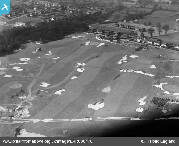
EPR000476 ENGLAND (1935). Sandy Lodge Golf Course, Eastbury, 1935. This image was marked by Aero Pictorial Ltd for photo editing.
© Copyright OpenStreetMap contributors and licensed by the OpenStreetMap Foundation. 2026. Cartography is licensed as CC BY-SA.
Nearby Images (3)
EPR000476

EPW031259

EPW020995

Details
| Title | [EPR000476] Sandy Lodge Golf Course, Eastbury, 1935. This image was marked by Aero Pictorial Ltd for photo editing. |
| Reference | EPR000476 |
| Date | 21-March-1935 |
| Link | |
| Place name | EASTBURY |
| Parish | |
| District | |
| Country | ENGLAND |
| Easting / Northing | 508998, 193363 |
| Longitude / Latitude | -0.42509885752639, 51.628042078921 |
| National Grid Reference | TQ090934 |
Pins
User Comment Contributions
The Cardinal bunker at Sandy Lodge GC. |

Lee P |
Monday 24th of October 2016 04:19:06 AM |