
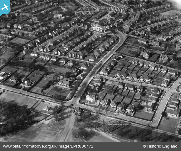
EPR000472 ENGLAND (1935). Residential area around Sheen Lane, East Sheen, 1935
© Copyright OpenStreetMap contributors and licensed by the OpenStreetMap Foundation. 2026. Cartography is licensed as CC BY-SA.
Nearby Images (2)
EPR000472

EPR000473

Details
| Title | [EPR000472] Residential area around Sheen Lane, East Sheen, 1935 |
| Reference | EPR000472 |
| Date | 21-March-1935 |
| Link | |
| Place name | EAST SHEEN |
| Parish | |
| District | |
| Country | ENGLAND |
| Easting / Northing | 520433, 174652 |
| Longitude / Latitude | -0.26635802832139, 51.45753011956 |
| National Grid Reference | TQ204747 |
Pins

Chris Willis |
Wednesday 26th of April 2017 03:03:50 PM | |
|
Chris Willis |
Wednesday 26th of April 2017 02:35:41 PM | |
|
Chris Willis |
Wednesday 26th of April 2017 02:34:11 PM | |
|
Chris Willis |
Wednesday 26th of April 2017 02:33:25 PM |