
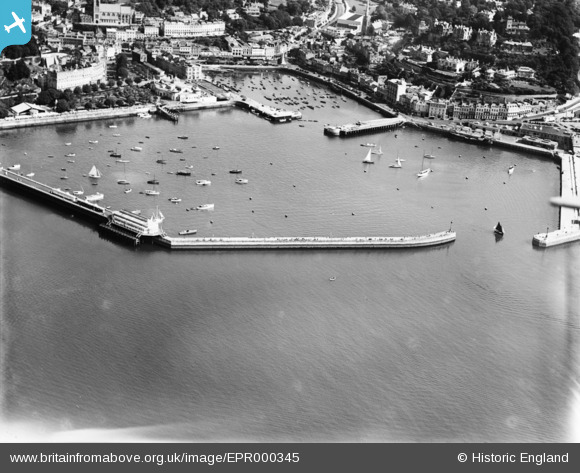
EPR000345 ENGLAND (1934). The Old and New Harbours, Torquay, 1934
© Copyright OpenStreetMap contributors and licensed by the OpenStreetMap Foundation. 2026. Cartography is licensed as CC BY-SA.
Nearby Images (19)
EPR000345

EAW007583

EPR000333

EAW007582

EPW033407

EAW047135

EPR000332

EPW033403

EAW011684

EPR000330

EPW023717

EPW023725

EAW030859

EAW047134

EPR000331

EAW011685

EAW011686

EAW031975

EAW011688

Details
| Title | [EPR000345] The Old and New Harbours, Torquay, 1934 |
| Reference | EPR000345 |
| Date | 11-September-1934 |
| Link | |
| Place name | TORQUAY |
| Parish | |
| District | |
| Country | ENGLAND |
| Easting / Northing | 291520, 63191 |
| Longitude / Latitude | -3.5284105342009, 50.457905479606 |
| National Grid Reference | SX915632 |
Pins
Be the first to add a comment to this image!