
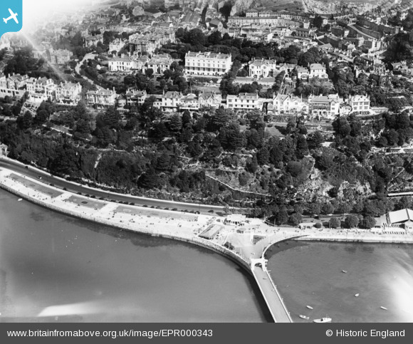
EPR000343 ENGLAND (1934). The Royal Terrace Gardens, Torquay, 1934
© Copyright OpenStreetMap contributors and licensed by the OpenStreetMap Foundation. 2026. Cartography is licensed as CC BY-SA.
Nearby Images (17)
EPR000343

EPR000339

EPR000341

EPR000344A

EPR000334

EPR000342

EPR000340

EAW031964

EAW031967

EAW011696

EAW031965

EAW031966

EAW031968

EAW011693

EAW030859

EPW023725

EAW011686

Details
| Title | [EPR000343] The Royal Terrace Gardens, Torquay, 1934 |
| Reference | EPR000343 |
| Date | 11-September-1934 |
| Link | |
| Place name | TORQUAY |
| Parish | |
| District | |
| Country | ENGLAND |
| Easting / Northing | 291474, 63601 |
| Longitude / Latitude | -3.5291772762107, 50.461583239081 |
| National Grid Reference | SX915636 |
Pins
Be the first to add a comment to this image!