
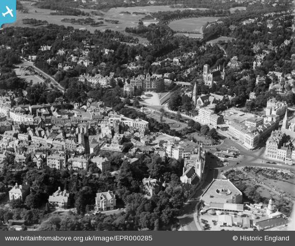
EPR000285 ENGLAND (1934). The Square, Central Pleasure Gardens and environs, Bournemouth, 1934
© Copyright OpenStreetMap contributors and licensed by the OpenStreetMap Foundation. 2026. Cartography is licensed as CC BY-SA.
Nearby Images (5)
EPR000285

EPW018158

EPW037421

EPW018161

EPW037420

Details
| Title | [EPR000285] The Square, Central Pleasure Gardens and environs, Bournemouth, 1934 |
| Reference | EPR000285 |
| Date | 26-August-1934 |
| Link | |
| Place name | BOURNEMOUTH |
| Parish | |
| District | |
| Country | ENGLAND |
| Easting / Northing | 408418, 91317 |
| Longitude / Latitude | -1.8807362298001, 50.720843568486 |
| National Grid Reference | SZ084913 |
Pins

Class31 |
Monday 19th of October 2015 08:26:49 AM | |
|
Class31 |
Monday 19th of October 2015 07:51:00 AM | |
|
Class31 |
Monday 19th of October 2015 07:49:43 AM | |
|
Class31 |
Monday 19th of October 2015 07:48:36 AM | |
|
Class31 |
Sunday 18th of October 2015 08:35:28 PM | |
|
Class31 |
Sunday 18th of October 2015 08:27:28 PM | |
|
Class31 |
Sunday 18th of October 2015 08:26:57 PM |


