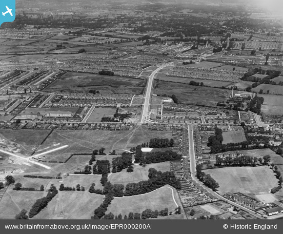
EPR000200A ENGLAND (1934). The Tithe Farm Housing Estate, South Harrow, 1934
© Copyright OpenStreetMap contributors and licensed by the OpenStreetMap Foundation. 2025. Cartography is licensed as CC BY-SA.
Nearby Images (5)
Details
| Title | [EPR000200A] The Tithe Farm Housing Estate, South Harrow, 1934 |
| Reference | EPR000200A |
| Date | July-1934 |
| Link | |
| Place name | SOUTH HARROW |
| Parish | |
| District | |
| Country | ENGLAND |
| Easting / Northing | 513286, 186432 |
| Longitude / Latitude | -0.36540721068688, 51.56489429149 |
| National Grid Reference | TQ133864 |
Pins
Be the first to add a comment to this image!


![[EPR000200A] The Tithe Farm Housing Estate, South Harrow, 1934](http://britainfromabove.org.uk/sites/all/libraries/aerofilms-images/public/100x100/EPR/000/EPR000200A.jpg)
![[EPR000198] The Tithe Farm Housing Estate, South Harrow, 1934](http://britainfromabove.org.uk/sites/all/libraries/aerofilms-images/public/100x100/EPR/000/EPR000198.jpg)
![[EPW040817] Sandringham Crescent, Alexandra Avenue and environs, South Harrow, from the east, 1933](http://britainfromabove.org.uk/sites/all/libraries/aerofilms-images/public/100x100/EPW/040/EPW040817.jpg)
![[EPW040818] Sandringham Crescent and environs, South Harrow, from the east, 1933](http://britainfromabove.org.uk/sites/all/libraries/aerofilms-images/public/100x100/EPW/040/EPW040818.jpg)
![[EPR000197] The Tithe Farm Housing Estate under construction, South Harrow, 1934](http://britainfromabove.org.uk/sites/all/libraries/aerofilms-images/public/100x100/EPR/000/EPR000197.jpg)