
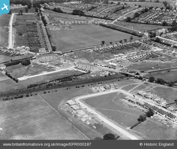
EPR000187 ENGLAND (1934). Highland Road, Joel Street and environs, Northwood, 1934
© Copyright OpenStreetMap contributors and licensed by the OpenStreetMap Foundation. 2026. Cartography is licensed as CC BY-SA.
Nearby Images (2)
EPR000187

EPR000186

Details
| Title | [EPR000187] Highland Road, Joel Street and environs, Northwood, 1934 |
| Reference | EPR000187 |
| Date | 23-July-1934 |
| Link | |
| Place name | NORTHWOOD |
| Parish | |
| District | |
| Country | ENGLAND |
| Easting / Northing | 510226, 190369 |
| Longitude / Latitude | -0.40830480945962, 51.60089016808 |
| National Grid Reference | TQ102904 |
Pins

The Laird |
Wednesday 6th of May 2015 11:47:02 AM | |
|
The Laird |
Saturday 2nd of May 2015 11:24:21 AM | |
|
The Laird |
Saturday 2nd of May 2015 11:23:15 AM | |
|
The Laird |
Saturday 2nd of May 2015 11:22:22 AM |