
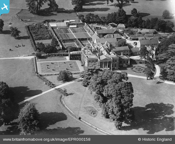
EPR000158 ENGLAND (1934). Neston Park, Neston, 1934
© Copyright OpenStreetMap contributors and licensed by the OpenStreetMap Foundation. 2026. Cartography is licensed as CC BY-SA.
Nearby Images (2)
EPR000158

EPR000247

Details
| Title | [EPR000158] Neston Park, Neston, 1934 |
| Reference | EPR000158 |
| Date | July-1934 |
| Link | |
| Place name | NESTON |
| Parish | CORSHAM |
| District | |
| Country | ENGLAND |
| Easting / Northing | 386192, 167122 |
| Longitude / Latitude | -2.1985217385235, 51.402464581292 |
| National Grid Reference | ST862671 |
Pins
Be the first to add a comment to this image!