
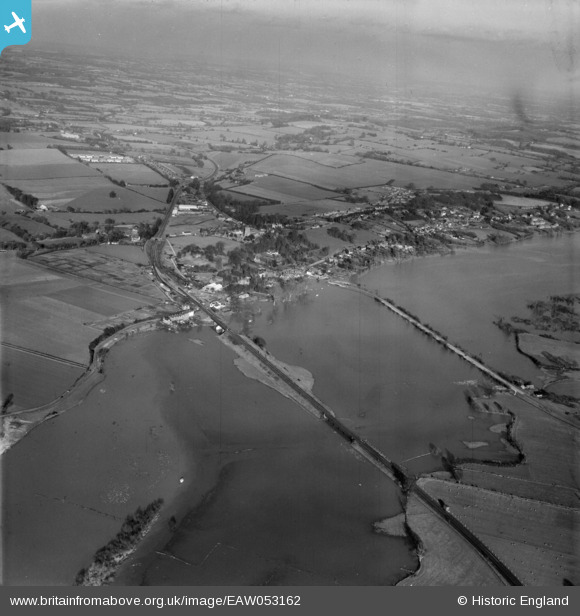
EAW053162 ENGLAND (1954). The River Arun in flood and the village, Pulborough, from the south-west, 1954
© Copyright OpenStreetMap contributors and licensed by the OpenStreetMap Foundation. 2026. Cartography is licensed as CC BY-SA.
Nearby Images (2)
EAW053162

EAW053161

Details
| Title | [EAW053162] The River Arun in flood and the village, Pulborough, from the south-west, 1954 |
| Reference | EAW053162 |
| Date | 20-February-1954 |
| Link | |
| Place name | PULBOROUGH |
| Parish | COLDWALTHAM |
| District | |
| Country | ENGLAND |
| Easting / Northing | 504020, 118222 |
| Longitude / Latitude | -0.51889603428485, 50.953483820821 |
| National Grid Reference | TQ040182 |
Pins

Adrian Backshall |
Friday 18th of December 2020 08:53:41 PM | |
|
Dan Gregory |
Saturday 20th of August 2016 02:16:24 PM | |
|
Dan Gregory |
Saturday 20th of August 2016 02:14:18 PM | |
|
Dan Gregory |
Saturday 20th of August 2016 02:01:03 PM | |
|
Dan Gregory |
Saturday 20th of August 2016 02:00:16 PM | |
|
Dan Gregory |
Saturday 20th of August 2016 01:58:52 PM | |
|
Dan Gregory |
Saturday 20th of August 2016 01:56:34 PM | |
|
Dan Gregory |
Saturday 20th of August 2016 01:55:54 PM |