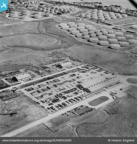
EAW053080 ENGLAND (1954). Part of the Coryton Oil Refinery, Coryton, 1954
© Copyright OpenStreetMap contributors and licensed by the OpenStreetMap Foundation. 2026. Cartography is licensed as CC BY-SA.
Details
| Title | [EAW053080] Part of the Coryton Oil Refinery, Coryton, 1954 |
| Reference | EAW053080 |
| Date | 4-January-1954 |
| Link | |
| Place name | CORYTON |
| Parish | |
| District | |
| Country | ENGLAND |
| Easting / Northing | 572156, 182513 |
| Longitude / Latitude | 0.48139426284885, 51.514788910578 |
| National Grid Reference | TQ722825 |
Pins
Be the first to add a comment to this image!


![[EAW053080] Part of the Coryton Oil Refinery, Coryton, 1954](http://britainfromabove.org.uk/sites/all/libraries/aerofilms-images/public/100x100/EAW/053/EAW053080.jpg)
![[EAW034238] Part of the Shell Haven Oil Refinery, Corringham, 1950. This image was marked by Aerofilms Ltd for photo editing.](http://britainfromabove.org.uk/sites/all/libraries/aerofilms-images/public/100x100/EAW/034/EAW034238.jpg)
![[EAW034239] Part of the Shell Haven Oil Refinery, Corringham, 1950. This image was marked by Aerofilms Ltd for photo editing.](http://britainfromabove.org.uk/sites/all/libraries/aerofilms-images/public/100x100/EAW/034/EAW034239.jpg)
![[EAW029142] Part of the Shell Haven Oil Refinery, Corringham, 1950. This image was marked by Aerofilms Ltd for photo editing.](http://britainfromabove.org.uk/sites/all/libraries/aerofilms-images/public/100x100/EAW/029/EAW029142.jpg)