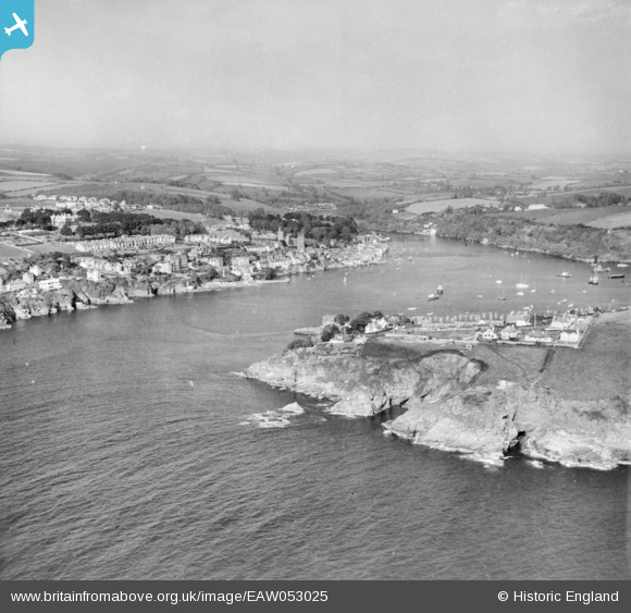
EAW053025 ENGLAND (1953). Polruan and Fowey Harbour, Polruan, from the south-west, 1953
© Copyright OpenStreetMap contributors and licensed by the OpenStreetMap Foundation. 2025. Cartography is licensed as CC BY-SA.
Nearby Images (2)
EAW053025

EAW051347

Details
| Title | [EAW053025] Polruan and Fowey Harbour, Polruan, from the south-west, 1953 |
| Reference | EAW053025 |
| Date | 19-November-1953 |
| Link | |
| Place name | POLRUAN |
| Parish | LANTEGLOS |
| District | |
| Country | ENGLAND |
| Easting / Northing | 212213, 50794 |
| Longitude / Latitude | -4.6386027206084, 50.326496931418 |
| National Grid Reference | SX122508 |
Pins

redmist |
Sunday 6th of November 2022 08:07:05 PM | |
|
redmist |
Sunday 6th of November 2022 08:02:14 PM | |
|
redmist |
Sunday 6th of November 2022 08:00:04 PM | |
|
redmist |
Sunday 6th of November 2022 07:58:36 PM |