
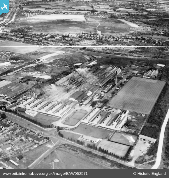
EAW052571 ENGLAND (1953). The Crane Ltd Nacton Works, Priory Heath, 1953. This image was marked by Aerofilms Ltd for photo editing.
© Copyright OpenStreetMap contributors and licensed by the OpenStreetMap Foundation. 2026. Cartography is licensed as CC BY-SA.
Nearby Images (21)
EAW052571

EAW052569

EAW052567

EPW046605

EPW046604

EPW046599

EPW046598

EAW052568

EPW046600

EPW046595

EPW046596

EAW052572

EAW052574

EPW032870

EPW046597

EPW046602

EPW046603

EPW032869

EAW052570

EPW046601

EAW052573

Details
| Title | [EAW052571] The Crane Ltd Nacton Works, Priory Heath, 1953. This image was marked by Aerofilms Ltd for photo editing. |
| Reference | EAW052571 |
| Date | 5-October-1953 |
| Link | |
| Place name | PRIORY HEATH |
| Parish | |
| District | |
| Country | ENGLAND |
| Easting / Northing | 619680, 242085 |
| Longitude / Latitude | 1.2030539372406, 52.033162295292 |
| National Grid Reference | TM197421 |
Pins

Matt Aldred edob.mattaldred.com |
Sunday 16th of February 2025 01:18:15 PM |