
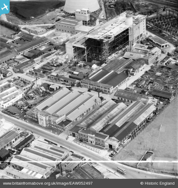
EAW052497 ENGLAND (1953). The Expandite Ltd Works and other factories, North Acton, 1953. This image was marked by Aerofilms Ltd for photo editing.
© Copyright OpenStreetMap contributors and licensed by the OpenStreetMap Foundation. 2026. Cartography is licensed as CC BY-SA.
Nearby Images (48)
EAW052497

EAW052499

EAW052502

EAW051488

EAW051482

EAW052494

EAW052496

EAW051483

EAW051487

EAW052498

EAW051484

EAW051490

EAW052503

EAW051489

EAW051486

EAW052501

EAW051485

EAW052495

EAW051481

EPW034975

EPW034976

EAW009109

EAW009099

EAW009105

EAW000469

EAW009106

EPW054156

EPW062169

EAW009107

EPW046952

EPW046955

EAW009103

EAW009101

EPW054159

EPW046953

EPW046958

EPW034969

EPW034969
EPW054161

EPW046957

EPW062166

EPW054160

EPW054157

EAW009104

EPW046956

EPW046954

EPW034967

EPW034967
Details
| Title | [EAW052497] The Expandite Ltd Works and other factories, North Acton, 1953. This image was marked by Aerofilms Ltd for photo editing. |
| Reference | EAW052497 |
| Date | 30-September-1953 |
| Link | |
| Place name | NORTH ACTON |
| Parish | |
| District | |
| Country | ENGLAND |
| Easting / Northing | 520900, 182670 |
| Longitude / Latitude | -0.25689156850672, 51.529499212564 |
| National Grid Reference | TQ209827 |
Pins
Be the first to add a comment to this image!