
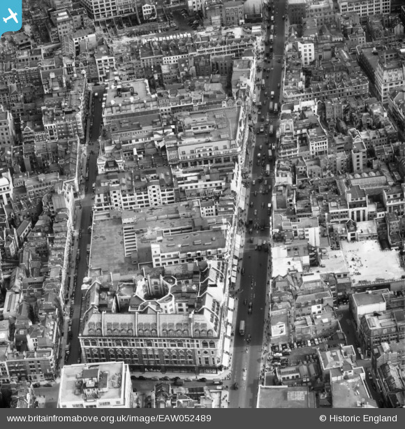
EAW052489 ENGLAND (1953). Oxford Street to the east of Oxford Circus, Westminster, 1953
© Copyright OpenStreetMap contributors and licensed by the OpenStreetMap Foundation. 2026. Cartography is licensed as CC BY-SA.
Nearby Images (16)
EAW052489

EAW050864

EAW052490

EAW050863

EAW050849

EAW050851

EAW050841

EAW050860

EAW050862

EAW050835

EAW050842

EPW047236

EPW012735

EAW050855

EPR000200

EPW021885

Details
| Title | [EAW052489] Oxford Street to the east of Oxford Circus, Westminster, 1953 |
| Reference | EAW052489 |
| Date | 30-September-1953 |
| Link | |
| Place name | WESTMINSTER |
| Parish | |
| District | |
| Country | ENGLAND |
| Easting / Northing | 529319, 181326 |
| Longitude / Latitude | -0.13606862072602, 51.51555402949 |
| National Grid Reference | TQ293813 |


