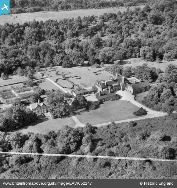
EAW052247 ENGLAND (1953). Bellasis, Box Hill, 1953. This image was marked by Aerofilms Ltd for photo editing.
© Copyright OpenStreetMap contributors and licensed by the OpenStreetMap Foundation. 2024. Cartography is licensed as CC BY-SA.
Nearby Images (9)
Details
| Title | [EAW052247] Bellasis, Box Hill, 1953. This image was marked by Aerofilms Ltd for photo editing. |
| Reference | EAW052247 |
| Date | 8-September-1953 |
| Link | |
| Place name | BOX HILL |
| Parish | |
| District | |
| Country | ENGLAND |
| Easting / Northing | 519353, 152610 |
| Longitude / Latitude | -0.28929543354875, 51.259630087749 |
| National Grid Reference | TQ194526 |
Pins
Be the first to add a comment to this image!


![[EAW052247] Bellasis, Box Hill, 1953. This image was marked by Aerofilms Ltd for photo editing.](http://britainfromabove.org.uk/sites/all/libraries/aerofilms-images/public/100x100/EAW/052/EAW052247.jpg)
![[EAW052244] Bellasis, Box Hill, 1953. This image was marked by Aerofilms Ltd for photo editing.](http://britainfromabove.org.uk/sites/all/libraries/aerofilms-images/public/100x100/EAW/052/EAW052244.jpg)
![[EAW052243] Bellasis, Box Hill, 1953. This image was marked by Aerofilms Ltd for photo editing.](http://britainfromabove.org.uk/sites/all/libraries/aerofilms-images/public/100x100/EAW/052/EAW052243.jpg)
![[EAW052249] Bellasis, Box Hill, 1953. This image was marked by Aerofilms Ltd for photo editing.](http://britainfromabove.org.uk/sites/all/libraries/aerofilms-images/public/100x100/EAW/052/EAW052249.jpg)
![[EAW052248] Bellasis and Bullen Wood, Box Hill, 1953. This image was marked by Aerofilms Ltd for photo editing.](http://britainfromabove.org.uk/sites/all/libraries/aerofilms-images/public/100x100/EAW/052/EAW052248.jpg)
![[EAW052250] Bellasis and Bullen Wood, Box Hill, 1953. This image was marked by Aerofilms Ltd for photo editing.](http://britainfromabove.org.uk/sites/all/libraries/aerofilms-images/public/100x100/EAW/052/EAW052250.jpg)
![[EAW052245] Bellasis, Box Hill, 1953. This image was marked by Aerofilms Ltd for photo editing.](http://britainfromabove.org.uk/sites/all/libraries/aerofilms-images/public/100x100/EAW/052/EAW052245.jpg)
![[EAW052246] Bellasis and Bullen Wood, Box Hill, 1953. This image was marked by Aerofilms Ltd for photo editing.](http://britainfromabove.org.uk/sites/all/libraries/aerofilms-images/public/100x100/EAW/052/EAW052246.jpg)
![[EPW025269] Headley Heath, Box Hill, from the north-west, 1928. This image has been produced from a copy-negative.](http://britainfromabove.org.uk/sites/all/libraries/aerofilms-images/public/100x100/EPW/025/EPW025269.jpg)