
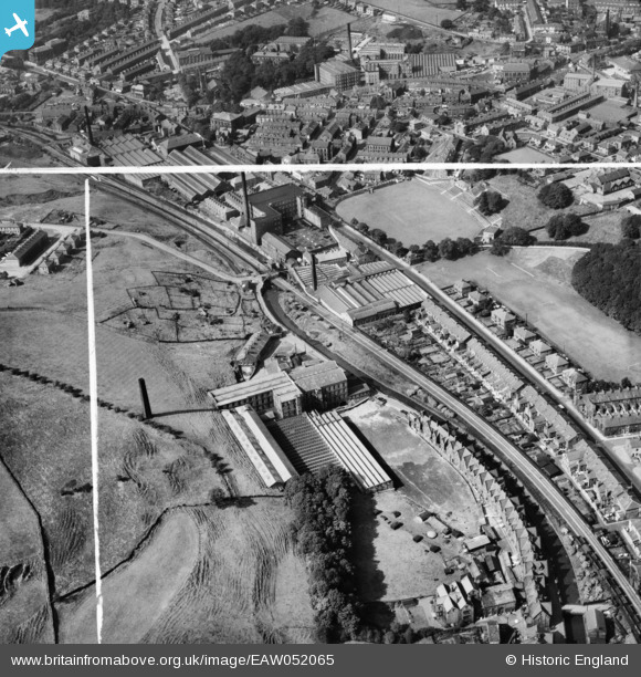
EAW052065 ENGLAND (1953). The Albion and the Hall Carr Cotton Mills and Worswick Memorial Cricket Ground, Rawtenstall, 1953. This image was marked by Aerofilms Ltd for photo editing.
© Copyright OpenStreetMap contributors and licensed by the OpenStreetMap Foundation. 2026. Cartography is licensed as CC BY-SA.
Nearby Images (7)
EAW052065

EAW052061

EAW052066

EAW052062

EAW052063

EAW052060

EAW052064

Details
| Title | [EAW052065] The Albion and the Hall Carr Cotton Mills and Worswick Memorial Cricket Ground, Rawtenstall, 1953. This image was marked by Aerofilms Ltd for photo editing. |
| Reference | EAW052065 |
| Date | 7-September-1953 |
| Link | |
| Place name | RAWTENSTALL |
| Parish | |
| District | |
| Country | ENGLAND |
| Easting / Northing | 381592, 422680 |
| Longitude / Latitude | -2.278852135792, 53.700005078554 |
| National Grid Reference | SD816227 |
Pins

wadey |
Thursday 5th of February 2026 11:05:19 AM | |
|
wadey |
Thursday 5th of February 2026 11:04:50 AM | |
|
wadey |
Thursday 5th of February 2026 11:04:06 AM | |
|
wadey |
Thursday 5th of February 2026 11:03:32 AM | |
|
wadey |
Thursday 5th of February 2026 11:02:20 AM | |
|
wadey |
Thursday 5th of February 2026 11:01:26 AM | |
|
wadey |
Thursday 5th of February 2026 11:00:43 AM | |
|
wadey |
Thursday 5th of February 2026 11:00:16 AM | |
|
wadey |
Thursday 5th of February 2026 10:59:42 AM | |
|
wadey |
Thursday 5th of February 2026 10:58:34 AM | |
|
wadey |
Thursday 5th of February 2026 10:58:01 AM |